Maling Ancient Path, Tonglu Valley Section
Shishe (石舍村, upstream end; the recording begins on the lane out of the village) 桐庐县富春江镇石舍村 → Luci (芦茨村, downstream end at the slow-life visitor station) 桐庐县富春江镇芦茨村(慢生活体验区旅游驿站)
Plan Your Route
Quick Facts
| Start | Shishe (石舍村, upstream end; the recording begins on the lane out of the village) 桐庐县富春江镇石舍村 |
| Finish | Luci (芦茨村, downstream end at the slow-life visitor station) 桐庐县富春江镇芦茨村(慢生活体验区旅游驿站) |
| Area | Tonglu |
| Transport | High-speed rail 杭州东 → 桐庐 in 33–53 minutes (¥44 second class), then bus K619 to 石舍 in 40–50 minutes for ¥6. That bus runs two or four times a day, which is the whole planning problem. |
| Crowd level | Editorial judgement on official counts: the three villages took 1.24 million visits in the first half of 2026, and 石舍 alone reported 1.8 million for 2025. Weekdays before 9:00, the lane is yours. May Day, National Day, the Dragon Boat holiday and the bamboo-shoot season put enough people on the narrow cliff at 蟹坑口 that walkers side-step. |
When to go
April and May, and October to mid-November, are the easy answers: spring brings bamboo shoots and rapeseed, autumn brings ginkgo colour and cooler shade. June to August is the water season, when the creek fills with waders and the valley is busiest, and it is also the hottest and wettest; the plum rain keeps the stone slick and a storm can put the lane under water at 百步街. January and February are quiet, grey, and inside the county's forest fire ban. Any month, the buses decide the day more than the weather does.
Route Summary
The ridge walk that is not a ridge walk
Zhejiang picked 115 paths for its first batch of Grade-1 ancient trails in December 2023, and 马岭古道 was one of them: 40.6 km end to end, of which Tonglu’s share is 14.8 km. Most of that line belongs to the hills. The saddle that gives the path its name, and the high ground shaped like a horse’s head, sit in Pujiang and Jiande, upstream. What Tonglu holds is the water side: a valley lane that follows 芦茨溪 down past three villages and hands it over to the Fuchun River.
So the walk is not what the name prepares you for, and that is the recommendation rather than the caveat. Measured from a track walked in March 2026, 石舍 to 芦茨 is 10.7 km, with about 120 m of cumulative climbing, a high point of 150 m and a floor of 48 m. The valley drops some seventy metres from one end to the other, and nearly all of that arrives in one place: forty-five metres of it in the half kilometre going down into 茆坪.
The hard part is the transport. Bus K619 runs from 桐庐 railway station up this valley to 石舍, and it does so two or four times a day, which makes the walk a scheduled operation rather than a morning idea. The rail leg from Hangzhou is under an hour and frequent; the valley leg is a village service with a village’s idea of frequency. Miss the afternoon bus and the answer is a ¥35 to ¥60 taxi, which on a holiday afternoon is a slow answer.
What you get for arranging it: a cobblebed lane that a 茆坪 man named 胡仲仁 paid to have paved over six years in the fourteenth century; three villages the state has separately decorated with heritage titles; and a road history that reads like the country’s. In 1969 five kilometres of this path were rebuilt as thirteen kilometres of preparedness road, the provincial highway cut the line in the 1970s, and a tunnel opened in 2008 took the last traffic off it. The stone survived because it stopped being useful. The GPS file this route is measured from ends at a restaurant called 金富饭庄, which is the most honest description of the finish anyone has written.
Step-by-Step Route
Shishe, and the lane that leaves before the village
50 minutes, 1.4 km石舍 is the upstream answer to a question most visitors never ask: what did a valley keep when the road went round it? Its Ming and Qing houses are a protected group, listed by the province in 2017, more than 3,000 square metres of timber behind whitewash, and the halls carry names rather than numbers: 存仁堂, 精义堂, 厚载堂, 敬义堂. A camphor at the village edge is given about twelve centuries, and an art gallery has made the place a sketching base for the China Academy of Art. Start at the bus stop and you add a few hundred metres of lane, because the walked line published here begins on the climbing road above the houses rather than at anyone's door.
The small saddle, and the only real descent
25 minutes, 1.3 kmThis stretch decides what the walk is. The lane climbs out of the valley on a steady grade, reaches high ground at about 1.4 km, runs a plateau for a kilometre, and then drops: forty-five metres over the next half kilometre, the steepest sustained thing on the route, and it is coming down. That half kilometre takes a fit walker about eight minutes. Below it the creek appears at 128 m with 茆坪's covered bridge on the far side. There is no view from the saddle and no marker on it. The name promises a ridge crossing; this is a valley lane with one short hill in it.
Caution: The descent is stone, often mossy, and shaded enough to stay wet after rain. It is also the one part of this walk where a fall would matter.
Maoping, the village that paid for the road
45 minutes, 0.4 km茆坪 is why the path exists. A local benefactor named 胡仲仁 put up the money and six years of labour to pave this valley with river cobble in the fourteenth century, and the village he left is listed twice over: a China Historic and Cultural Village since 2019, a Traditional Village since 2014. Roughly seven in ten households carry the 胡 surname. The ancestral hall, raised in 1772 and covering more than 1,800 square metres, shows as under renovation in the map listings; 文安楼, built between 1922 and 1925, is the house people stop at. Three-hundred-year trees, a covered bridge at the lower end and a fifteen-yuan noodle bowl are the rest of the pitch.
Photo suggestion: The bridge at the village's lower end works best in the morning, with the sun still on the far hill rather than in the frame.
Seven kilometres of creek lane
1 h 15, 3.6 kmFrom 茆坪 to 蟹坑口 the walk becomes the thing it is listed for: a cobblebed and flagstone lane averaging about 1.2 m wide, crossing the creek on stepping stones, a suspension bridge and a second covered bridge, and meeting the provincial road more than once where the valley narrows. 百步街 is the famous name here, and the profile is worth knowing before you arrive: across the kilometre each side of the lane the valley gives up two metres, so whatever the stone does, this is not the climb the guidebooks promise. The named 马岭古道 point sits where the lane meets the road, and 蟹坑口 is where the cliff squeezes the path to its narrowest.
Caution: Some plank sections have rotted through, with a channel nearly two metres deep under them, and the road crossings come around bends.
Luci, and the slow-life end
1 hour, 3.3 kmBelow 蟹坑口 the valley opens and the path stops pretending to be remote. 芦茨 claims the Tang poet 方干 as its own and repeats a story about eighteen examination successes from one settlement, and since September 2012 it has been the core of the first rural slow-life experience zone the provincial government approved, 62 square kilometres that also hold 白云源 and the boat-only 严子陵钓台. A provincial 3A scenic village label followed in 2018 and a national forest village one in 2019, which in practice means tea rooms, an electric-boat pontoon and a good deal of weekend traffic. The 金富柴火饭店 that the walk's own GPS file names as its finish is here, and so is the tourism station.
The last half kilometre, and the way back
20 minutes, 0.5 kmThe station and the village committee office arrive at about 10 km, with toilets, seating and the shuttle that may or may not be running. The recorded line carries on another half kilometre to where the creek gives up its name to the Fuchun River, which is the right place to decide the afternoon. If the bus is on your side, take it back up the valley to 石舍 for your car or straight on to 桐庐站. If it is not, call a taxi and watch the river road on the way out, because that is the only part of Tonglu you will see without walking.
Getting There & Back
Rail to Tonglu, then K619 up the valley
BestTake the 杭黄高铁 from 杭州东 to 桐庐: 33 to 53 minutes, ¥44 second class, frequent enough to treat as a commuter train. Outside the station, bus K619 runs the valley to 石舍, and the measured itinerary is 6,097 seconds door to door with 554 m of walking for ¥6. The catch is frequency: two to four departures a day, so build the walk around that bus and confirm the day's buses before setting out.
If the bus has gone, or the day has
A taxi or ride-hail from 桐庐站 to 芦茨 covers 18.7 km in about half an hour, which turns a missed bus from a ruined day into a cost. The same call works in reverse, but on a holiday afternoon the empty cars are back in the county town, so book rather than wave. To stay on the network, K619's sister routing runs through 富春江农贸市场 and links 芦茨 with K606.
By car, and where to park
The 杭新景高速 to the 桐庐 or 富春江 exit, then the provincial road into the valley; set your navigation on 芦茨村, 石舍村, 茆坪村 or the 慢生活体验区旅游驿站 rather than on the creek. Village parking is mostly free, with a few boards asking 10 to 20 yuan a day, so treat the on-site notice as the price. A point-to-point walk needs two cars or a bus back, which is why the public-transport version is the one written up here.
Links inside the valley
K606 runs between 富春江农贸市场 and 西坑口 through the valley, and 芦茨 to 茆坪 measures 2,108 seconds for ¥2 on it or on a K619 working the same road. That makes a half-day sensible: walk the creek lane from 茆坪 to 芦茨, which is the heart of the route, and let the bus give you back the 2.7 km above 茆坪. A seasonal shuttle in the slow-life zone is reported but has no published stops.
Getting back the same day
ReturnThe valley closes on itself: the last practical bus is an afternoon one, and after it there is no evening service to wait for. Leave 芦茨 with time to spare, or take the taxi option above and be in 桐庐 for dinner. 大奇山森林公园, the county's other day out, has been closed since October 2025 and is not a same-day pairing; 严子陵钓台 opposite the mouth is reached by cruise boat, not on foot.
Photo Guide
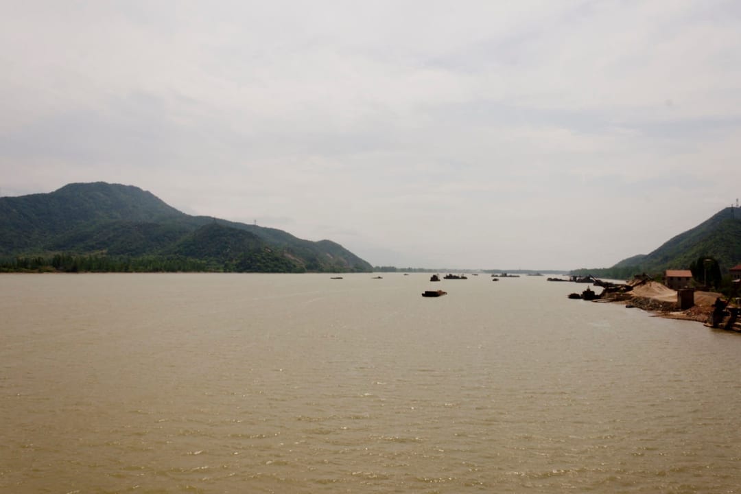
Key photo points along the route.




Practical Notes
One distance, one climb
The figures here are the walked ones, given in full at the top and nowhere else. Twelve-kilometre and fourteen-kilometre versions circulate in market write-ups and add village detours and spur links; nothing here measures them, so treat those as longer walks rather than as this walk.
The buses are the difficulty
Two to four K619 departures a day turns a gentle walk into a scheduled operation. Go early, finish by mid-afternoon, or accept the taxi. The 61路 listings with neat morning-and-noon times that circulate online are from the route's 2019 trial period, before it was renamed and extended to 石舍.
Nothing is charged, and nothing is staffed
No ticket for the path or for any of the three villages, and no reservation system to book through. Money changes hands only for optional things: roughly ¥80 for half an hour in an electric boat, ¥50 an hour for a kayak, or ¥150 for a licensed fishing outing on the river.
Do the middle on a full water bottle
Supply points on the creek lane between the villages are counted in single figures and are not guaranteed open. Shade is thin on the 茆坪 to 芦茨 stretch in July, and the one thing this valley has in plenty is water you should not drink untreated.
Names on the map that are not on this line
仁寿桥, 文昌阁, 五朝门, 鱼鳞坝, 玉阶古桥, 厚载堂, 鱼梁坝 and the village camphor all appear in the literature on these three villages. None of them resolved to a map point we would trust, so they are named here and never marked. A place does not become findable because a guidebook lists it, and no pin here pretends to place them.
Start upstream if you can
Walking 石舍 to 芦茨 takes the fall downhill instead of uphill, ends where the parking, the food and the station are, and puts the easiest taxi pick-up at your finish. The reverse is a legitimate walk and a harder afternoon.
The surface is historic and uneven in the same sentence
River cobble, flagstone and stone steps, with cement at the village edges and a farm track where the lane meets a field. Ankle-high footwear is not overkill on wet days, and the plank sections are why you watch the ground rather than the view.
Give the villages an hour each
This is not a walk to spend all its time walking. 茆坪 rewards the hall and the bridge, 石舍 the lanes above the creek, 芦茨 lunch. The moving pace of the walk we measured was 3.6 km/h, which assumes nobody stopped for tea.
Weekdays, or early
The official counts run past a million visits a half-year across three villages, and the narrow 蟹坑口 section cannot absorb a holiday crowd two abreast. A weekday before nine gives you the lane; a National Day afternoon gives you a queue at a bridge. The forest fire ban covers the woodland margin, so leave the stove home.
Safety Notes
- The Fuchun reservoir releases water through the summer, sometimes with twelve to seventeen gates open, and the river below the valley mouth is closed to navigation during releases: bank-side wading, fishing and swimming are prohibited by notice, and the creek channel beside the lane is nearly two metres deep.
- After heavy rain the channel at 百步街 can run level with the lane. Do not walk this section in a storm or immediately after one, and do not assume a plank that looks sound is sound.
- Parts of the wooden boardway have rotted through with the channel directly beneath, and the guardrail is newer than the path it protects.
- The lane crosses the provincial road several times between 茆坪 and 芦茨, in places at blind bends where the road takes the valley's only flat ground.
- Stone is slippery with moss and there is no lighting on the path: an evening walk here means a head torch and a very good reason.
- Mobile coverage on the mid-valley sections is reported as patchy. Tell someone which end you started from, since the two ends are an hour of road apart.
- Village dogs are a routine hazard on the lanes between houses; do not run, and give a walking stick something to be interested in rather than your ankles.
- Snakes and mosquitoes are summer facts on the grassy edges, and the winter fire ban covers the woodland sections on either side of the lane.
Frequently Asked Questions
Short answers to common planning questions about transport, Chinese place names, timing, and safety for this route.
-
Can I actually do this without a car?
Yes, and the walk was measured on that assumption. Rail from 杭州东 reaches 桐庐 in under an hour, and bus K619 runs from the station forecourt up the valley to 石舍 for ¥6. The caveat is frequency: two to four departures a day each way, on a schedule that changes. Take the morning bus and you can be back in Hangzhou for dinner. -
Does it matter which end I start from?
More than the distance suggests. Starting at 石舍, upstream, takes the valley's fall downhill and puts the toilets, the food and the easier taxi at your finish. Starting at 芦茨 means climbing out of the valley in the first hour and an afternoon spent getting back to where you started. Both are the same walk; one is a better day. -
Is ten kilometres too much for my family?
It is a long distance with an easy profile: the climbing across the whole route is less than a single West Lake hill, and the only steps worth worrying about are the short descent into 茆坪. What tries children is the middle: no toilets, thin shade, nothing to buy for seven kilometres. Under eight, do 茆坪 to 芦茨 and bus back. -
Do I need a ticket or a reservation?
No to both. The ancient path is open ground and the three villages charge nothing to enter; there is no booking system and no official cap or reservation notice for 2025 or 2026. Money is for optional extras: a boat to rent, a fishing outing on the river, tea in a room that serves it, and possibly a parking board. -
Is this the same path as the one that crosses the Maling ridge?
Same trail system, different geography, and this is where published accounts go wrong. The designated Grade-1 path runs 40.6 km across three counties, and the high ground that gives it its name lies in Pujiang and Jiande. What Tonglu holds is the water side: the valley lane. If a description of this walk has you crossing a pass, it is another county. -
What does the valley do in the wet season?
It floods, and it is managed for it. The reservoir upstream releases through the summer, the river closes to navigation, and 百步街 is the section that goes under first. June and July also keep the stone permanently slick. Come after a dry week; in a wet one, walk the village lanes and skip the creek. -
What is there to see in each of the three villages?
石舍 is the architectural one: a protected Ming and Qing house cluster, hall names on the doors, a camphor older than the path, and studios that bring drawing students in summer. 茆坪 is the historic one: ancestral hall, 1920s house, academy, covered bridge. 芦茨 is the living one: tea rooms, boats, the station. -
Can I get out mid-way, or cross to the road?
You can cross the road repeatedly: the lane meets it several times between 茆坪 and 芦茨, useful in an emergency and the reason to watch children there. Getting out for a bus is another matter. The stops that count are at the two ends and at 万福桥 below 茆坪, and flagging is not reliable on a route with so few departures. -
Can I combine this with another Tonglu sight in a day?
Not on foot and not by bus. 严子陵钓台 opposite the valley mouth is a cruise-boat site at about ¥120 to ¥125 for ticket and crossing together. 白云源, which looks close, is 20 km of road walking from 石舍. 大奇山森林公园 has been closed since October 2025. Treat this as a full day and sleep in the valley. -
How real are the numbers here?
The distance, the climbing and the grades come from one walked GPS track recorded in March 2026, and its coordinate system was tested against named bridges and villages rather than assumed. The timings are arithmetic on that track's pace. The bus schedule, the parking price and the hall's scaffolding are yours to check.
Nearby Routes
Other trails starting from the same area, worth combining or visiting on another day.